Maximum Alert in the Azores Archipelago
The Azores Islands, an autonomous Portuguese archipelago in the North Atlantic, are in a hurricane alert state due to the imminent approach of Hurricane Gabrielle. According to the latest reports from the National Hurricane Center (NHC) of the United States, based in Miami, the meteorological phenomenon is moving through the open waters of the ocean with a trajectory directed directly towards the island territory. The alert was officially issued by the Portuguese Meteorological Service (IPMA), activating emergency protocols in the region.
At the end of Wednesday, Gabrielle was categorized as a category 3 tropical cyclone on the Saffir-Simpson hurricane scale, presenting maximum sustained winds of 185 km/h (115 mph). Its movement was recorded in an east-northeast direction, with a center located approximately 2,189 kilometers (1,360 miles) west of the Azores. Although forecast models indicate progressive weakening, it is anticipated that the system will maintain hurricane intensity at the time of its closest proximity to the archipelago during Thursday night and early Friday.
Expected Impact and Associated Hazards
Gabrielle’s approach carries a combination of hazardous conditions that will last through Friday. Forecasters are predicting significant coastal flooding and large destructive waves posing a serious threat to security and infrastructure in coastal areas. It is estimated that accumulated precipitation could reach up to 127 millimeters (5 inches) in the central and western islands of the archipelago, increasing the risk of landslides and flash floods.
A critical aspect of this event is the large-scale waves generated by the hurricane. These powerful storm surges are already affecting distant areas such as Bermuda, the entire East Coast of the United States—from North Carolina northward—and the Atlantic Coast of Canada. Authorities have warned of the high probability of deadly rip currents along these coasts, an underestimated but extremely lethal danger for swimmers and boaters. The hurricane’s energy spreads hundreds of kilometers from its center, demonstrating the extensive reach of these weather systems.
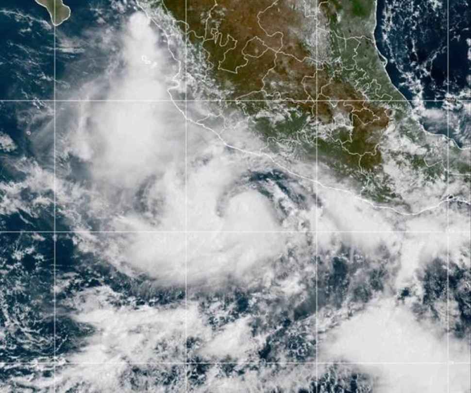
Situation in the Pacific Ocean: Hurricane Narda
At the same time, in the Pacific Ocean basin, Hurricane Narda has shown a different evolution. This cyclone intensified on Tuesday, reaching category 2 with maximum sustained winds of 169 km/h (105 mph). However, unlike Gabrielle, Narda is moving westward, progressively moving away from the Mexican coast. In its last report, the system was located about 869 kilometers (540 miles) south of the southern tip of the Baja California Peninsula. As it does not represent a direct threat to the mainland, no coastal warnings or alerts have been issued, and it is expected to continue its trajectory out to sea.
The simultaneous analysis of both phenomena highlights the unpredictability and diversity of behavior in the hurricane season. While Gabrielle heads towards a direct impact with a populated territory, Narda follows a route that minimizes its danger. This technical comparison is crucial to understand that the trajectory, rather than the initial intensity, is the determining factor in risk assessment.
For the Azores, the immediate priority is preparation. Residents and authorities should focus on securing properties, review evacuation plans and stay informed through official IPMA and NHC channels. The time window to make these preparations is limited, so quick and decisive action is essential to mitigate the effects of the hurricane.
Did you find this detailed analysis useful?Share this crucial information on your social networks to keep your community informed and explore our weather section for more real-time updates.


