Intensification of tropical cyclone One-E and its effects
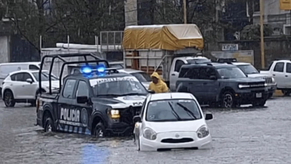
The Tropical Cyclone One-E has increased its power as it advances parallel to the coasts of Michoacán, Colima and Jalisco, generating extreme weather conditions in much of the Mexican territory. This weather system interacts with low pressure channels and the influx of moisture from three sources: the Gulf of Mexico, the Pacific Ocean, and the Caribbean Sea. As a result, widespread precipitation, intense winds and dangerous waves are forecast in western coastal areas. Additionally, an atypical cold front is approaching the north of the country, which will worsen the rains in that region.
Impact by federal entities
Guerrero: Recorded torrential rains with high risk of flooding and landslides, while a heat wave persists.
Jalisco, Colima and Michoacán: They experience intense precipitation, wind gusts of 50 to 70 km/h and high waves (2-3 meters). The heat wave in these areas has ceased.
Nayarit: showers with heavy rains and an end to the extreme heat are expected.
Center of the country (Guanajuato, Querétaro, Hidalgo, Tlaxcala, Puebla): The precipitations will be accompanied by electrical activity and possible hail.
Mexico City and State of Mexico: Probability of scattered rain during the afternoon and night.
Oaxaca and Chiapas: Intense rains continue, along with high temperatures.
Veracruz: The precipitations will be heavy to torrential due to the increase in humidity coming from the gulf.
Yucatan Peninsula (Campeche, Tabasco, Yucatán): While the extreme heat persists in Campeche, Tabasco and Yucatán could register isolated rain in the afternoon.
North of the country (Coahuila, Durango, Nuevo León, Tamaulipas): The cold front will cause showers and intense occasional rains.
Northwest (Chihuahua, Sonora, Sinaloa): Although there will be sporadic rains, the warm climate will dominate, especially in Sinaloa.
Baja California and Baja California Sur: Partly cloudy skies without significant rain.
Recommendations and official monitoring
The authorities, including Conagua and the National Meteorological Service (SMN), urge the population to remain alert through official sources and follow the Civil Protection instructions. The main risks include flash floods, landslides and dangerous storm surges in coastal areas. Constant monitoring of the cyclone and other weather systems continues to issue timely alerts.
How to prepare? Review emergency protocols, avoid crossing river beds and protect important documents. Conditions could change quickly.
Share this information on your social networks to keep your community informed and explore more weather updates on our site.